How To Use Technology To Find Public Hunting Land
It's easier than ever to find public land. Here's how to do it.
Technology has helped hunters in a number of ways. Faster shooting and more accurate compound bows have extended the distance at which archers are lethal, laser rangefinders and ballistic technology have given rifle hunters a similar advantage, and scent control clothing, sprays, and devices have helped hunters fool their quarry’s sensitive noses. But possibly the best use of technology for hunters is the ability to find public land from anywhere in the world. Here are a few tips on how to use technology to find your new public land honey hole.
Pick a State and Species
The same tools may work for someone looking to go on a Montana elk hunt and another person who wants to chase ducks in Louisiana. However, focusing on the state and species that you are after will drastically shorten the process and give you more time to focus on which public land areas are likely to hold the most game.
Visit the State’s DNR Website
The first thing to do in your effort to find public land is visit the website of your chosen state’s DNR or wildlife agency. Tons of information can be gleaned in a relatively short amount of time and this will give you a good starting point in your search for public land.
For example, let’s say that you want an upper Midwest whitetail in the worst way and have chosen Minnesota as the state to hunt. By logging onto their site, you can access wildlife management areas information on the state’s 1.29 million acres of WMAs. Searches can be conducted to show WMAs in a specific county, as well as those that provide opportunities for different species and wheelchair accessibility.
Aside from publicly owned lands, many states offer walk-in hunting opportunities on private lands owned by individuals and large companies. You can find maps of these underused hunting areas on your state’s wildlife management website.
If you’re looking for a place to chase spring gobblers or deer near your urban or suburban home in the east, both Pennsylvania and Virginia have excellent online search engines that can be used to locate hunting areas and view maps that will help you get away from the crowd.
After visiting their selected state’s DNR website, hunters chasing western game should check out the Bureau of Land Management's site. There you’ll find interactive maps as well as opportunities to order paper maps showing BLM boundaries.
Mobile Mapping Technology
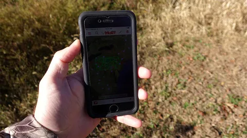
If you’re hunting near the public/private land boundary, there is no better tool to ensure that you are on the right side of the line than onXmaps land ownership maps. These maps are available for your GPS unit, smartphone, or computer. Not only do they help you find public land, they help you stay legal if you are hunting near the border and, if public land is lacking, they give you the names of the folks whose doors you’ll be knocking on to ask permission. OnXmaps are available in all fifty states and are a wise investment no matter what type of hunting you’ll be doing.
Keep in mind that carrying a phone or GPS map doesn’t negate the need for a paper surface map somewhere in your pack. Batteries die and electronics get broken. Have a backup if your high-tech navigational plan fails.
Hit Up Online Forums
Hunters love to tell hunting stories and hunting forums give them a place to do so. Once you’ve selected the state and general area that you’ll be hunting, starting a thread on a hunting forum about a specific public land area can give you clues on where and how to hunt it. Don’t expect folks to tell you the precise location of their favorite glassing spots, but any information that will point you in the right direction is better than going in blind on opening day.
The large amount of public land available to hunters is one of the greatest things about our country. Use technology to find the perfect hunting area for you and your chosen species, then get out there and start taking advantage of this precious resource.


 Guidefitter, Inc © 2012-2024